Users' Diaries

Recent diary entries

I’ve been building openski.org, inspired by OpenClimbing. There shouldn’t be so many private tracking and navigation ski apps, and the data can be updated easier while one waits on a ski lift.

What it does

  • Piste maps from OpenSkiData (the data behind OpenSkiMap)
  • Routes for skis and snowboards with a maximum piste difficulty, and options to avoid drag lifts and flat stretches
  • An hourly estimate of snow, sun, flat light and wind for each piste, from the forecast and the terrain
  • Live open/closed status where the resort publishes it, and lift queues counted on webcams (the people counter runs in your browser and shows the picture it counted on)
  • Track recording and GPX import
  • English, German and French

Any feedback? I was using it for some days before, but wasn’t confident enough to publish my OSM changes

Posted by Renanuma on 21 November 2026 in English.

Hello, my name is Numa Garen-ere, Im a student of federal university, Otuoke. Department of environmental management and toxicology. I was invited for state of the map Nigeria Uyo 2026 conference in Uyo. It was a great experience as it was my first time attending. We learned a great deal about mapping and discoveries, I also had a great time after the conference, we went for tour and it was amazing to see the culture of Uyo around the environment. SOTM was a great experience for me. Thank you all for this opportunity given to us.

Posted by skfd on 20 November 2026 in English.

StreetComplete is on iPhone now, and I’m question so very much on my long walks. Not enjoying fall landscapes no, not noticing quirky villager buildings – just glancing around and mostly looking at the screen tapping away… I love StreetComplete too much, so fun and useful.

GoMap!! is also great so I even survey the sidewalks and bike parking and what not in it. Same problem – too much screentime.

I also feel uneasy capturing all the easy obvious things How would I involve new people into hobby, if the only thing left to survey would be roof shapes and weather restaurant sells kosher?

I think I should leave fun easy quests and tasks for new mappers, and focus on imports, community organizing, and tool making.

Location: Hanlon Creek Neighbourhood Group, Guelph, Southwestern Ontario, Ontario, Canada
Posted by Jack_Regan on 20 November 2026 in English.

A while back I noticed someone had mapped a farmyard i.e. the boundary of the farmyard only, but there was none of the farm buildings mapped within it. So I added them.

Then I found another, same story; then another, there was a lot of them! Farmyards with zero buildings.

This is a job for Overpass Turbo [OT], I thought. My first attempt was to use the “around” command or filter or whatever its proper name is. Find farmyards with no buildings within a certain distance. I’m certainly no Overpass Turbo expert but I can write my own queries as long as they’re not too complex.

My method didn’t work very well, so I asked ChatGPT for some help. It soon told me I was using the wrong method and with a little bit of effort we eventually had a working query.

A couple of years ago chatbots/LLMs were absolutely hopeless at writing OT queries, often outputting complete nonsense. Now? They can write and debug complex queries far better than I can.

I live in Perth and Kinross, so the query was built around the relevant relation (ID: 1915429) for the P and K council area (it’s very large).

Overpass Turbo found somewhere in the region of 1500+ farmyards in the area. Roughly one third had no buildings (as at 02 October 2026) so a lot of mapping to do.

I saved the results of the query and imported it into JOSM as a new layer so I wouldn’t have to run the query again.

I’ve been working through them, trying to do at least 4 or 5 every day.

The same query could easily be altered to find residential landuse with no buildings, or blank construction areas which now have buildings waiting to be mapped.

Obviously, the relation ID can also be switched to work another area.

Future tasks

Find the farms with no name, and research the name (old OS map?)

Repeat for landuse=residential with no buildings mapped (a quick checked returned around 300?! Seems high?

Posted by Peter Elderson on 19 November 2026 in English.

(I’ll keep the roundabouts round for this article; other shapes are not that different where it comes to mapping.)

Structure

Usually there is a central circle, the central natural/landuse/leisure, surrounded by a paved ring, surrounded by a wedgeshaped circle of kerbstones: the apron (aka truck apron).

Central natural/leisure/landuse

The days of plain grass roundabout islands are over, in Nederland. You can still find them, but most centre islands have bushes, art, trees, shrubberies, hedges, flowerbeds, statues and monuments, even hills, paths, walls and landscape examples. Many are used for commercial purposes, e.g. as garden showcases.

My take on that is to map it as what it’s made to look like. If it is made to look like a beach, garden, wood or park, I tag it as a round beach, garden, wood or park, usually with access=no (there are exceptions even to that!).

The apron ring

The apron ring is most often paved with stones, but I have seen many other materials. My take on this is: I don’t map the apron ring itself, only the apron kerb ring.

The apron kerb

Apron kerbs are designed as easily traversable barriers, but the further you traverse them, the more unpleasant it gets. Regular cars will usually not traverse the apron kerb, even though it would not harm the car. I map the kerb by drawing the outside kerb circle and tag it as barrier=kerb, + kerb=apron (ATYL).

The whole island

The central island is the whole area within the apron kerb way, including the central natural. I tag it as area:highway=central_island (YOLO, I mean, ATYL). I could put the tag on the apron kerb way, but that mixes features as wel as data types. Luckily, there is an established method to use tagged way elements a outlines of an area: the multipolygon. In this case the MP is very simple: only one outer, no inner. The apron kerb way is the outer, and the area:highway=central_island tag goes on the MP area.

… See full entry

Good maps grow through careful observation, clear sources, and respectful review. Before changing a feature, it helps to check the existing data, explain the reason in the changeset, and confirm that the published result reflects the intended edit.

For boundary-related work, I think it is especially useful to keep official reference maps clearly attributed and separate from OpenStreetMap’s community-maintained data. A detected change should lead to an evidence-based review of the object history and sources, rather than assumptions about the contributor’s intentions.

This general project note is shared by the operator across accounts in the same mapping workspace. It does not announce a map edit or claim a community consensus.

Good maps grow through careful observation, clear sources, and respectful review. Before changing a feature, it helps to check the existing data, explain the reason in the changeset, and confirm that the published result reflects the intended edit.

For boundary-related work, I think it is especially useful to keep official reference maps clearly attributed and separate from OpenStreetMap’s community-maintained data. A detected change should lead to an evidence-based review of the object history and sources, rather than assumptions about the contributor’s intentions.

This general project note is shared by the operator across accounts in the same mapping workspace. It does not announce a map edit or claim a community consensus.

Posted by Peter Elderson on 18 November 2026 in English.

When I joined the OSM-community, landcover was being proposed. The idea ws to get non-landuse landuse tags and non-natural natural tags out of the landuse and natural keys. I especially dislike landuse=grass because grass is not landuse. If grass is used for something, it is meadow or farmland or e.g. decoration, separation and the like. So the landcover seemed a goed idea to me.

Since then, I’ve changed my view. Only two values make sense: grass and trees. Trees already has two alternatives: natural=wood and landuse=forest. At the data user side, both just mean an areas of mainly trees. Landcover=trees only adds a third option to tag the same thing. Grass has three estrablished tags: landuse=grass, landuse=meadow and natural=grassland. These are more distinctive than the tree tags, but that is mainly at the mapper’s side; they think they make a distinction, but on the data user side it’s all just land covered with grass.

All the other proposed values are covered by the appropriate values in the natural key, and there is nothing wrong with that: objects in the natural key are objects which grow, flow or form by nature: life forms, and geological forms, in contrast to man_made objects. When man mimics natural objects they are still categorized as naturals: beach, water bodies, tree rows. Workable.

And, trees and grass also have appropriate natural tags: natural=wood and natural=grassland. This makes a move to the landcover key unnecessary. Combined with the fact that currenty the landcover tags are usually added to one of the established tags for grass and trees, which means that the full transition will never occur, I now opt for dropping the landcover key and using established naturals instead.

… See full entry

Der richtige Name ist noch kein stufenloser Weg

Stellen wir uns einen Umstieg in Wien vor. Die Straßenbahnlinie ist richtig benannt, das Verkehrsnetz stimmt, der Bahnsteig liegt an der richtigen Stelle. Am Eingang hängt ein Zettel: „Aufzug außer Betrieb. Bitte den gegenüberliegenden Zugang benutzen.“ Wer einen Rollator schiebt, möchte wissen, ob dafür eine Bordsteinkante überwunden werden muss. Wer den Zettel nicht sehen kann, braucht die Information erst einmal in einer anderen Form. Und wer die Ersatzroute für OpenStreetMap prüfen will, steht vor einer ganz praktischen Frage: Welches Werkzeug nehme ich mit, und was kann ich damit verlässlich feststellen?

Was der Apps-Katalog noch nicht verrät

Der OSM Apps Catalog führt Anwendungen und Dienste zusammen, die OSM-Daten nutzen; seine Angaben stammen unter anderem aus dem OSM-Wiki, Wikidata, GitHub und Taginfo. Für diesen Beitrag habe ich den Katalogstand vom 18. November 2026 ausgewertet: Von 2.353 Einträgen hatten nur 13 überhaupt einen Wert im Feld screenReader, ausdrückliche Nein-Angaben mitgezählt. Das bedeutet nicht, dass nur 13 Apps mit Screenreadern bedienbar sind. Es bedeutet, dass jemand, der darauf angewiesen ist, diese Frage anhand des Katalogs fast nie entscheiden kann.

Dabei gibt es gute Werkzeuge: WalkersGuide beschreibt Kreuzungen und ist für die Nutzung mit TalkBack ausgelegt; Touch Mapper erzeugt tastbare Karten; AccessMap berücksichtigt persönliche Präferenzen zu Steigungen und Hindernissen, ist aber auf ausreichend gute lokale Fußwegdaten angewiesen. Im Katalog würde ich deshalb zwei Fragen nebeneinanderstellen: „Was weiß die App über die Zugänglichkeit eines Ortes?“ und „Kann ich die App selbst bedienen?“ Ein Rollstuhl-Routingprofil beantwortet die zweite Frage ebenso wenig, wie eine tastbare Papierkarte die Unterstützung einer Braillezeile belegt.

Was der Name Suggestion Index damit zu tun hat

… See full entry

Location: Katastralgemeinde Leopoldstadt, Leopoldstadt, Wien, 1020, Österreich
Posted by Harry Wood on 17 November 2026 in English.

The next London OSM meet-up will be December 9th at the Monkey Puzzle.

Last time we were at “The Volunteer” pub! Obviously with a name like that, I hoped this would be a good pub for us to have our gathering of volunteer mappers, and to show solidarity with the unpaid bar staff. But it turns out this pub was pretty noisy and busy, and what’s more, I suspect the staff were actually being paid :-) I booked a table for 8 but got a table with four places. I suppose the idea was that it’s big enough for 8 people to drink around, which we put to the test, and then about 12 people arrived, and then we ordered food. So it was a bit of squeeze, but fun!

OSMLondon at the volunteer (not quite during peak crowdedness)

User spiregrain was there (impressive editing run!). He’s from Statford, so we talked about mapping there, and we were remembering having a massive Westfield shopping mall mapping party there. Looking back at the old diary entry now, I see this was 2011. I’d forgotten we organised to go there shortly after the mall opened.

… See full entry

Location: East Marylebone, Mayfair, City of Westminster, Greater London, England, W1T 3PP, United Kingdom
Posted by Pascal Boulerie ENSG on 17 November 2026 in Italian (Italiano).

How can I add the second Italian name Cima Conturines to Piz dles Cunturines - the first Italian name being Cima Cunturines ?

osm.org/node/2409254827 46,5757050 and 11,9777711

This other name is mentioned in Wikipedia English and Italian :

https://en.wikipedia.org/wiki/Piz_dles_Cunturines

Location: Val Pusteria, Bolzano, Trentino-Alto Adige, Italia

I run Aloe Energy, a small not-for-profit initiative working on energy access in Sub-Saharan Africa. We published a free interactive map of the Southern African Power Pool grid, and OpenStreetMap is its backbone, so I wanted to share how it was built and where OSM could use help.

What we did. We took every OSM power line of 66 kV and above across the 12 SAPP countries (country extracts from November 2026). Where OSM had no line but an older public map did, we filled the gap from TANESCO (2015) and World Bank (2017) grid maps, but only for lines recorded as existing, with a known voltage, and more than about 3 km from any OSM line. A “Source and age” view on the map colors each line by where it comes from, so you can see exactly what is OSM and what is gap-fill.

Where OSM is thin. Coverage is weakest in Tanzania, DR Congo and Angola. Those are the places where the map still leans on maps that are close to ten years old, and where new mapping would change the picture most. Substations named in national plans are often missing too.

The map: https://aloeenergy.org/research/sapp-grid. There are also maps for the Eastern Africa Power Pool and Madagascar built the same way.

OSM data is credited as “OpenStreetMap contributors (ODbL)”, and the OSM-derived line data is available on request under the ODbL. The project register and plant list we compiled are free to download under CC BY 4.0 at https://aloeenergy.org/data. If you map power in the region and spot something wrong, I would be glad to hear about it and point people to fix it in OSM.

V předchozích letech jsem si všímal stavu malých vodních toků v okolí mého bydliště. Přes léto se výrazně projevovalo sucho, ale ještě před pár lety byly ty potůčky slabé, přesto trvalé. V roce 2024 a 2025 už došlo na potoku Hučnice k zásadní změně. Prostě přestal téct.

Místní, co mají v okolí své zahrádky, měli dokonce podezření, zda Hučnice neztrácí vodu nějakou konkrétní událostí. Ať už přirozenou cestou, protože někde hluboko pod potokem jsou štoly bývalého grafitového dolu, nebo snad lidským zásahem, že by někdo vodu čerpal. U Hučnice nebylo co odhalit. Voda Hučnice prostě z jižního úpatí Kleti zmizela.

Ostatní potůčky okolo Českého Krumlova taky nemají vyhráno. A Chvalšinský potok s Polečnicí, což jsou zde v okolí největší přítoky Vltavy, měl letos docela nízký stav vody. Při mapování se pak věnuji úpravě vodních toků tam, kde v nich voda už dlouho netekla.

Odkazy

O tématu vody v krajině jsem psal

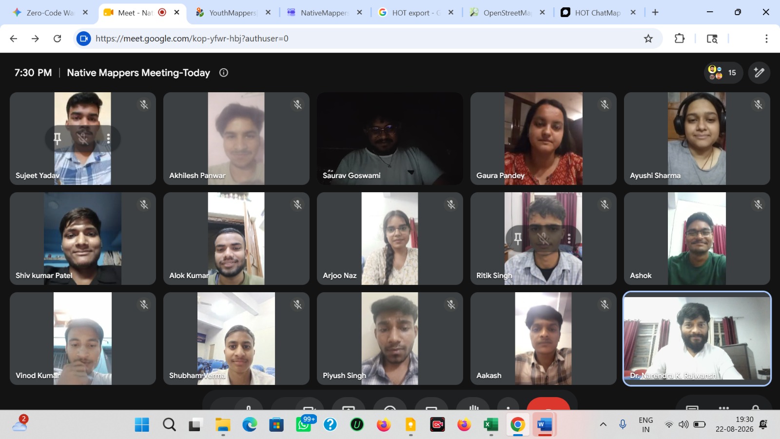
Image: Students and faculty coming together to build the Native Mappers community at HNBGU, Uttarakhand.

Native Mappers First Meeting at HNBGU

22 August 2026 Department of Geography, Chauras Campus, Hemvati Nandan Bahuguna Garhwal University, Uttarakhand, India

A new student-led mapping initiative, Native Mappers, is taking shape at Hemvati Nandan Bahuguna Garhwal University (HNBGU), Uttarakhand. The initiative aims to bring university students closer to OpenStreetMap (OSM), collaborative mapping and the wider open mapping community.

The first meeting at the Department of Geography, Chauras Campus, introduced students to the idea of building a university-based mapping community where they can learn practical skills, contribute geographic information and work together on local mapping projects.

Connecting Local Mapping with Global Opportunities

… See full entry

Location: Devprayag, Tehri Garhwal, Uttarakhand, India