


Temporary vehicle closure of Broadway at Main Street starting January 26
One block of E. Broadway between Main and Quebec streets is closed to vehicles until May 20 to facilitate traffic deck removal work. E. Broadway will reopen to vehicle traffic with one lane in each direction on May 20. See below for a map of the traffic changes as part of the work.
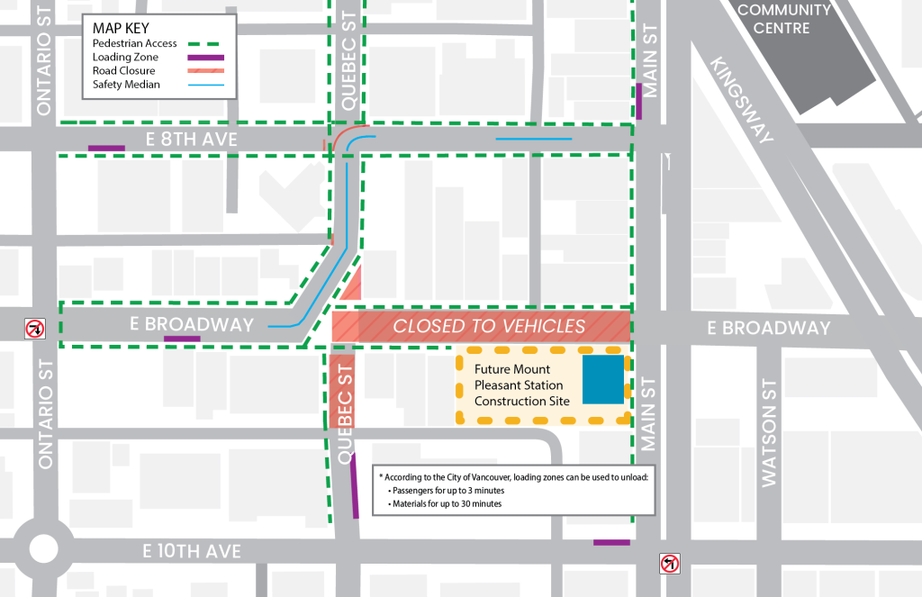
Parking and Access Maps
In collaboration with key partners, the Broadway Subway Project has developed alternative parking and access maps for the station areas along the Broadway corridor. Listed locations, including bus stops, are subject to change. Transit users are encouraged to check TransLink’s Trip Planner for updated locations of bus stops.
To download and print, click on a map, then right-click and select “save image as…”


Greenway Detours


Additional Map Resources


Interactive Project Map
Click “L” for Legend