Beschrijving
This plugin allows user to insert the USGS river data into their site in real time. By providing the plugin with the USGS ID number a widget or shortcodes can be generated to get the station name, current water level, water level graph and USGS link.
Features:
Display
- Widget
- Shortcode (automatically generated using metabox)
Information Available:
- Station Name
- Current Water Level
- Current Gage Level in feet
- Water Level Graph
- Gage Height Graph
- Station Url
- Cache river information for a designated amount of time to speed up load time.
Schermafbeeldingen
screenshot-1.png 
screenshot-2.png 
screenshot-3.png 
screenshot-4.png
Installatie
- Upload the unzipped contents of
usgs_river_data.zipto the/wp-content/plugins/directory - Activate the plugin through the ‘Plugins’ menu in WordPress
FAQ
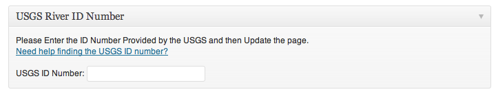
Finding the USGS Station ID
There are two ways to find the data you can either use the USGS Station Finding Site or use google (google is much easier).
To Find on Google
- Google “USGS Real-Time Water Data (Your Station)” where (Your Station) is the name of the station you want to find ie. Chagrin River.
- Click the Link to the corresponding USGS site that display the current water level ex: http://waterdata.usgs.gov/oh/nwis/uv?04209000
- Once you confirm this is the ccorrent site take the 8 diget code from the url just found and plug it into the plugin ie. 04209000 for the example above.
- Your Done!
- What are the shortcodes I can use?
-
Shortcode Cookbook
Note: # refers to the usgs id number[river id=’#’]
Displays all of the information based on the configuration options set on the settings page.
See “Settings” -> “River Options” to change.[river id=’#’ config=’#’]
Enter in the optional configuration number (1,2,3) to use one the the three options.[river_name id=’#’]
Displays the name of the station.[river_level id=’#’]
Displays the current water level of the station.[river_gage id=’#’]
Displays the current gage height in feet.[river_station id=’#’]
Displays the URL of the station.[river_graph id=’#’]
Displays the url of the image graph.
Ex:[river_gage_graph id=’#’]
Displays the url of the gage height graph.
Ex:
Beoordelingen
Bijdragers & ontwikkelaars
“USGS River Data” is open source software. De volgende personen hebben bijgedragen aan deze plugin.
BijdragersVertaal “USGS River Data” in je eigen taal.
Interesse in ontwikkeling?
Bekijk de code, haal de SVN repository op, of abonneer je op het ontwikkellog via RSS.
Changelog
1.21
*Minor variable change.
1.2
*Added Cacheing capabilities for improved speeds on pages with multiple shortcodes.
1.12
*Fixed bug where general output was being displayed above text.
1.11
*Fixed minor bug, station graph would not display without gage graph.
1.10
Added Gage height and gage graph options to the plugin.
Fixed missing images on options page.
Corrected various links.
1.01
- Fixed minor bug in river_data.php and river_custom_meta.php
1.0
- Launch