Hi GEONETCasters,
As a complement to the GEONETCast-Americas Illustrated Product List, please find below the links for the Quick Guides of some of the products available on GNC-A (40 quick guides for now). On these Quick Guides you’ll find why the product is important, its impact on operations (primary application), limitations, interpratation and resources.
ABI (Advanced Baseline Imager):
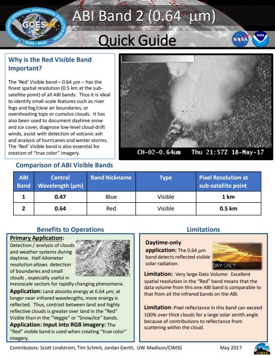
Band 02: 0.64 μm (“Red”) – Link
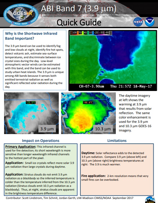
Band 07: 3.9 μm (“Shortware Window”) – Link
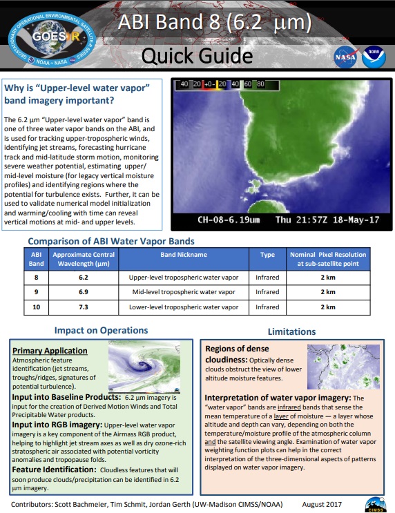
Band 08: 6.2 μm (“Upper-Level Tropospheric Water Vapor”) – Link
Band 09: 6.9 μm (“Mid-Level Tropospheric Water Vapor”) – Link

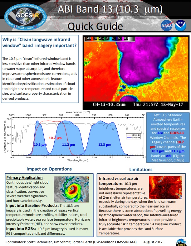
Band 13: 10.3 μm (“Clean” IR Longwave Window) – Link
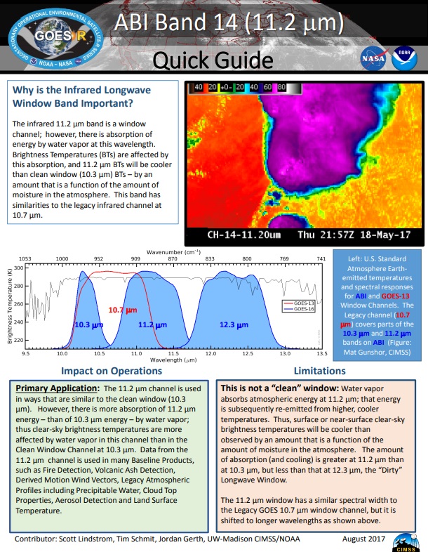
Band 14: 11.2 μm (IR Longwave Window) – Link
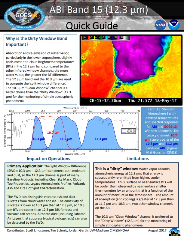
Band 15: 12.3 μm (“Dirty” Longwave Window) – Link
GLM (Geostationary Lightning Mapper):
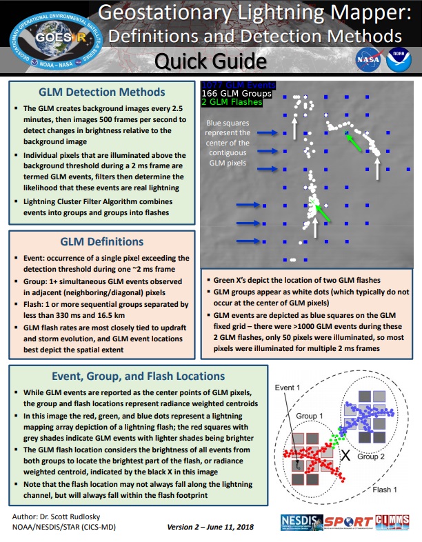
Events, Groups and Flashes (5 minutes) [the gridded product available on GNC-A is not exactly as the one mentioned on the third link, but the general idea is the same] – Link 1, Link 2, Link 3


Baseline Products:
Aerosol Detection (Smoke and Dust) – Link

Aerosol Optical Depth – Link

Clear Sky Masks – Link

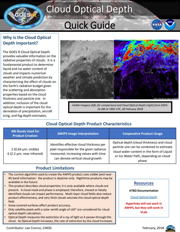
Cloud Optical Depth – Link
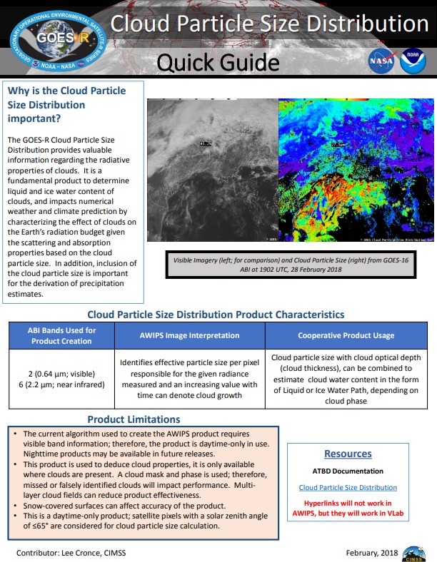
Cloud Particle Size Distribution – Link
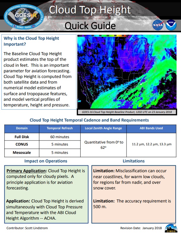
Cloud Top Height – Link
Cloud Top Phase – Link

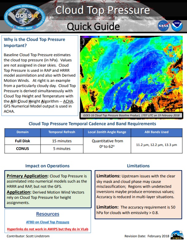
Cloud Top Pressure – Link
Cloud Top Temperature – Link

Derived Motion Winds – Link

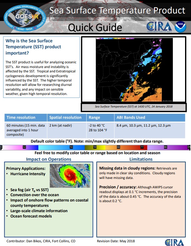
Sea Surface Temperature (Skin) – Link
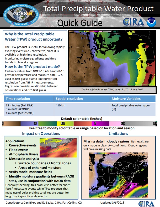
Total Precipitable Water – Link
Volcanic Ash – Link

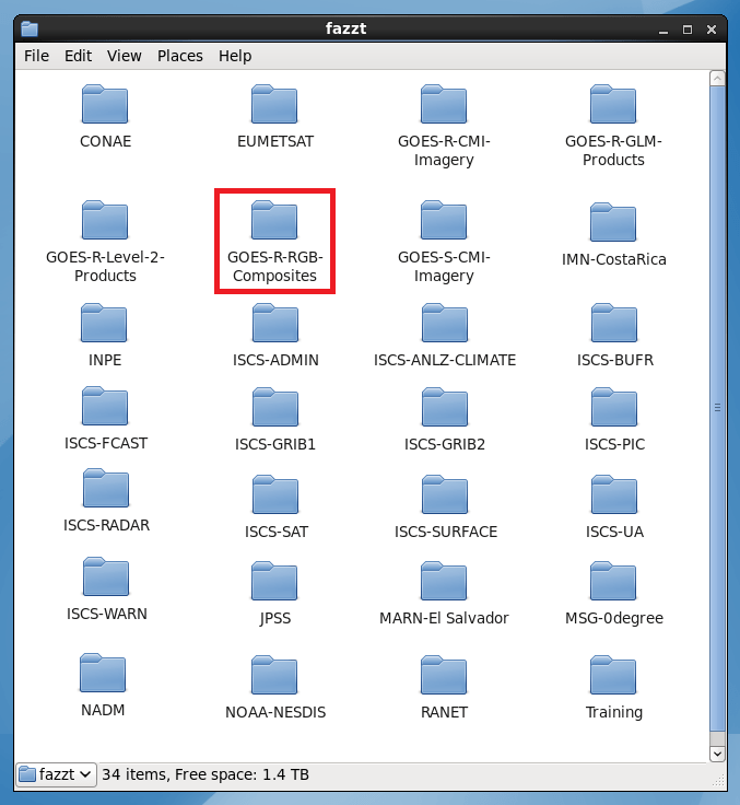
Multispectral Imagery / RGB Composites:
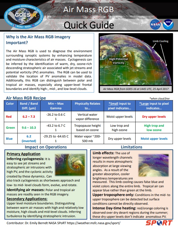
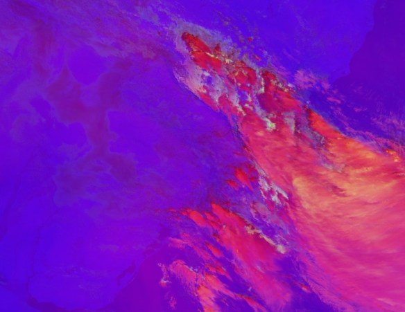
Airmass – Link
Cloud Phase – Link

Day Cloud Convection – Required post reception processing – Script available! – Link

Day Cloud Phase Distinction – Link

Day Convection – Link

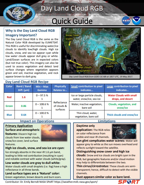
Day Land Cloud – Link
Day Microphysics – Link

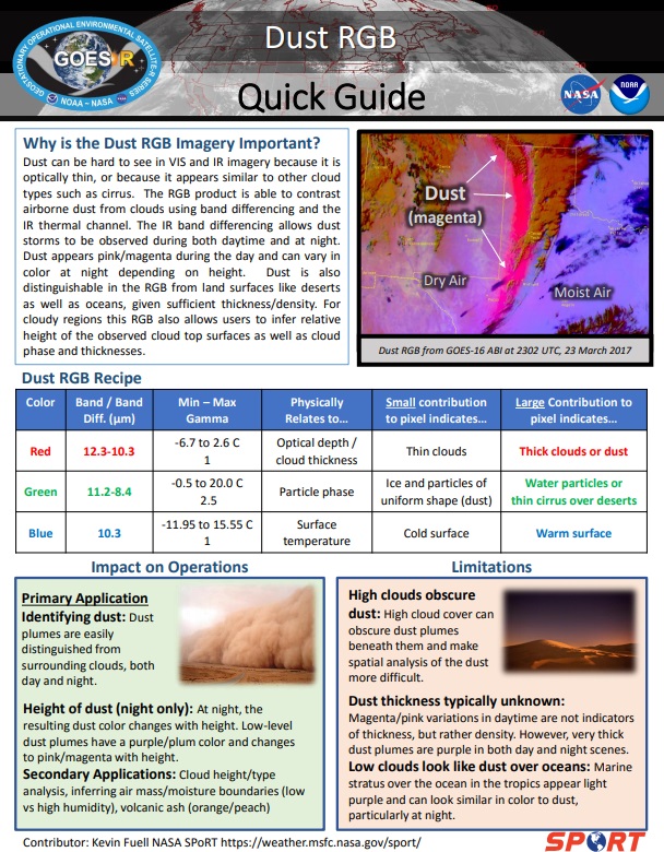
Dust – Link

Natural True Color – Link

Night Microphysics – Link

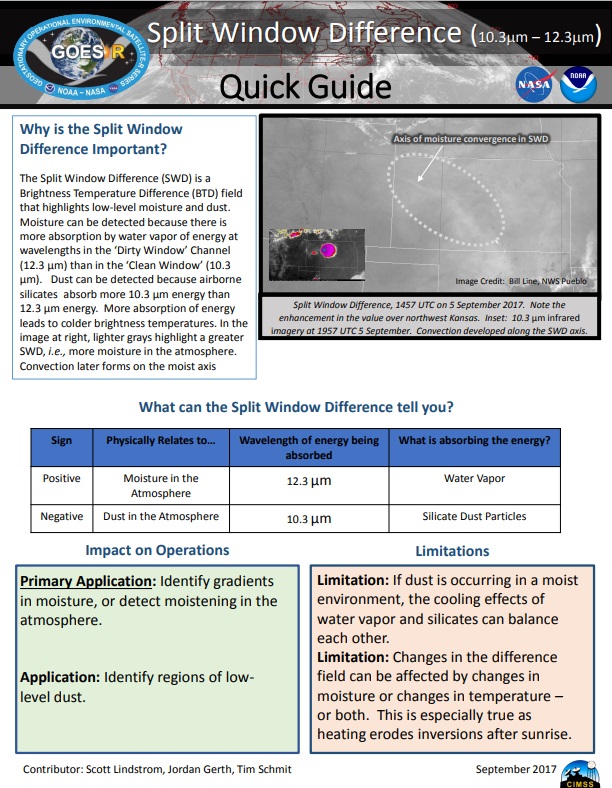
Split Window Difference (10.3 um – 12.3 um) – Required post reception processing – Script available! – Link
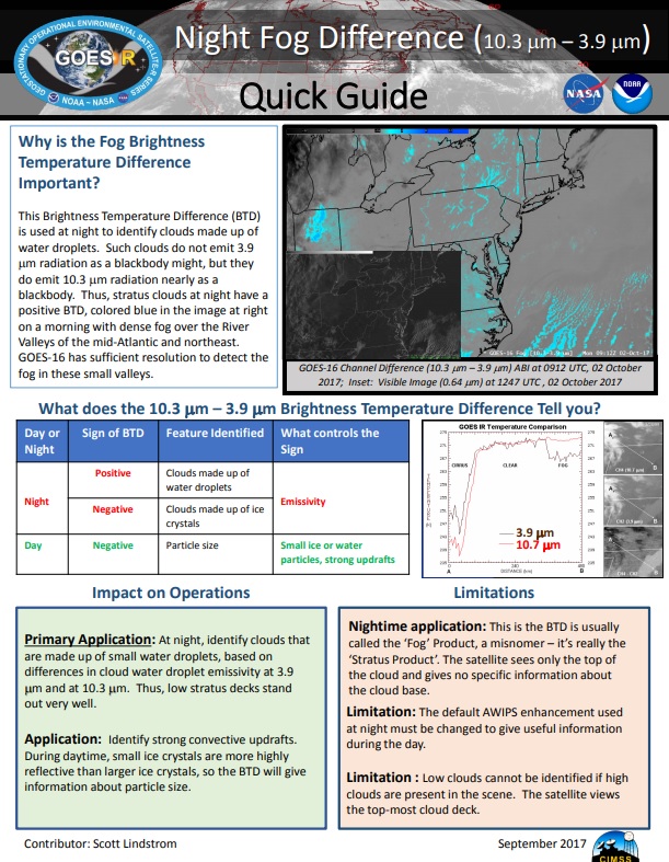
Night Fog Difference (10.3 um – 3.9 um) – Required post reception processing – Script available! – Link
JPSS:
NUCAPS Soundings – Link

Blended TPW – Link

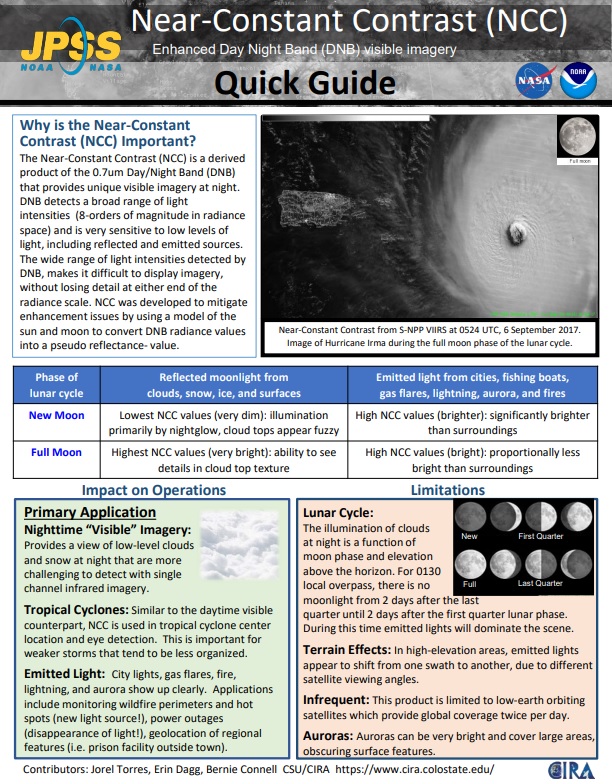
Near-Constant Contrast – Day Night Band: 0.7 um (“Low Light Visible”) – Required post reception processing – Script available! – Link
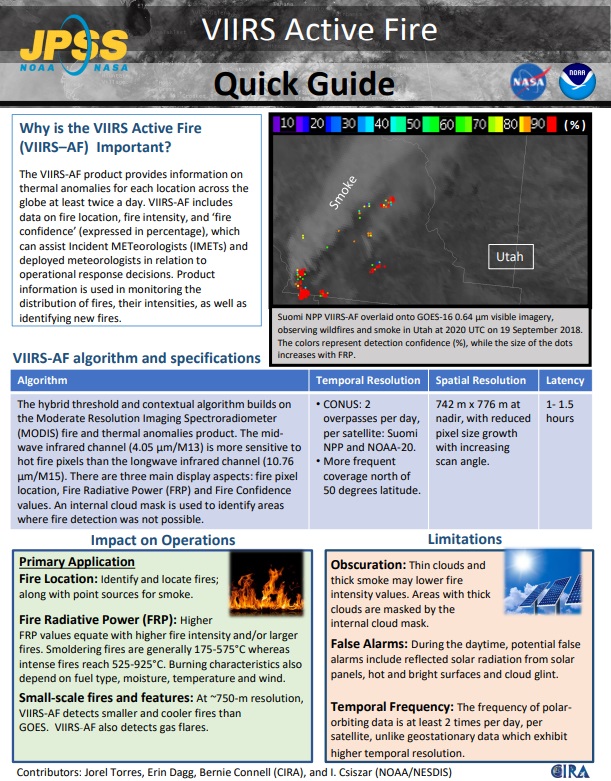
VIIRS Active Fire – Link
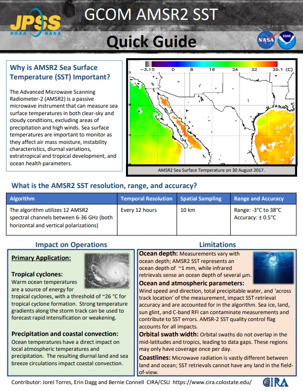
GCOM AMSR2 SST – Link


 Naming convention:
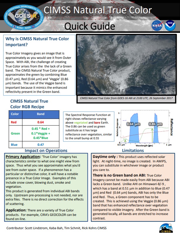
 Naming convention:
 Naming convention:
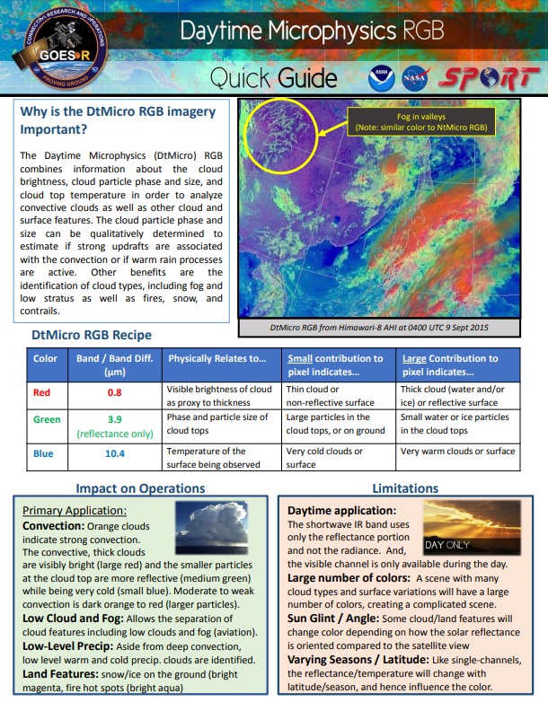
 Naming convention:
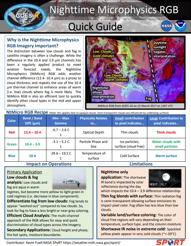
 Naming convention:
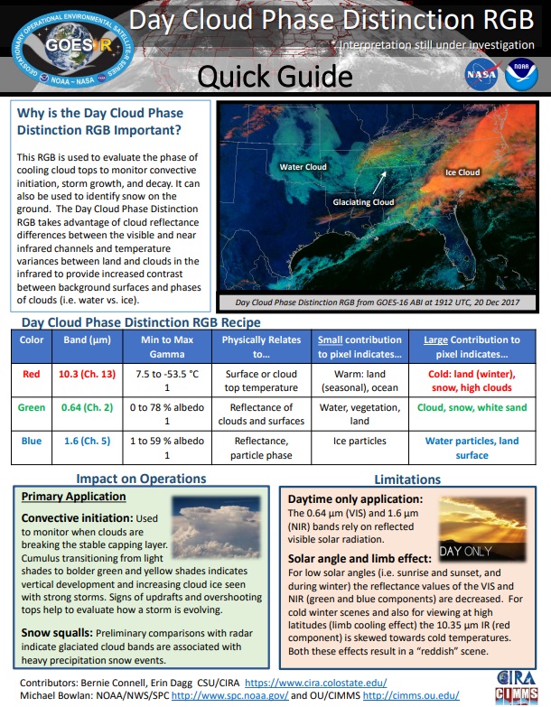
 Naming convention:
 Naming convention:
  Naming convention: