I find that campaigns tend to run for a year before the seasonal break (whatever season it’s nicest to be outside in your climate). So it makes sense to scale a campaign to that timeline. Whether you actually complete it is impossible to tell; perhaps nearing the end of a campaign will encourage players to prioritize the game over fair weather.
I don’t write stories and try to estimate a 1-year progression. Instead, I write places and set up starting conditions, and how those will probably progress assuming the players don’t affect them. Because players have the freedom to wander, I prefer not to build a linear area because they could easily get off the developed path; a linear area works very well for a voyage if you include branching paths that tend to make their way back to the center at various points. Regardless, I call this large area a campaign theater (in the military sense).
THEATER SCALE
My 1-year campaign theaters are 30×30 miles of terrain on a map with 1 mile per square, on graph paper that’s 5 squares per inch. I prefer graph paper that comes with a blank border, because it looks so much cleaner, but you’ll have to look around for it. Engineers seem to use it, so you might pick up some branded for Boeing or whatever at a yard sale, but I’m sure they’re sold at stationery stores. I could use hexes, but it isn’t vital. It just helps with marking travel and making the map look more organic. Also tradition. An adventure site is too small to appear as anything but a dot on the theater map, but you can use different dot icons for different types of sites.
The map is marked across the left side with numbers, 1-30, from top down. Across the top we mark A-Z from left to right, and after Z (the 26th square across) go with AA, AB, AC, AD. This lets you write down coordinates like Excel cells.
You will build an index. Just list all your adventure sites and their coordinates. Now copy that list and to the side make a copy. Sort the left index by coordinate, the right by site name. Now you can look at your map and get coordinates and look at the index to tell you what is there, or you can look for a site name on the other index to get its theater map coordinates.
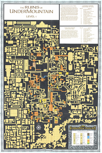
DUNGEON SCALE
Within that the dungeon / hazard zones are two-page dungeon format (map and key on left page, room details on right page) with 300’x300′ maps (30×30 10′ squares). I like this because you have everything you need without flipping pages. If it’s a simpler or smaller adventure site I’ll revert to One Page Dungeon format and make sure I put another OPD on the facing page, so every other site preserves its two-facing-pages structure. If it’s a multi-level dungeon it helps to line up the stairs down on one page with the stairs up on the next, as you flip.
A village can be on one of those dungeon-scale area maps but maybe with a scale of 50′ per square, so we’re drawing building footprints but no interiors, we get small roads and streams, and farm plots delineated. The whole village is thus up to 1500′ across (~1/4 mile) but probably a lot of rough undeveloped area around the outside. It really helps to make all your village maps the same scale as each other so you instantly get a feel for them in comparison. And you can draw the village as a roughly one-quarter square on the 30 mile theater map.
A small town with a wall will tend to have a lot of denser development inside, meaning that large population can still fit within the same scale map. The walls can be near the edge of the mapped area, with indications of roads leading away which correlate with marked roads on the 30 mile theater map. Also show the nearest edges of the nearest farms, extending out away from the town. If the players head out there and explore/interact with a family just stick with broad strokes. A fenced area, some animals and crops (enough to be self-sufficient), beehives. A walled compound with a big house, animal pens, chicken coop, a big tub in the yard for washing clothes. Watch a little footage of Kingdom Come: Deliverance for what I’m envisioning.
CITY MAPS
A larger city of thousands needs a larger map. There’s probably just one city in your theater, but even if more, it’s okay to use a different scale for them. Try to change the header at the top of the page to make it clear this is a big city, to point out the scale difference. You might use 100′ per square. At this scale you’re drawing city blocks rather than individual buildings.
Your city map needs the same coordinate system as your theater map. You might also consider putting down icons for inns, shops, and guard posts/barracks (so, just three icons) on the map to identify these locations that tend to be very important to players, and also use those icons in your index next to the buildings. In Word, you can insert an image, and I’ve been able to use an image as a custom bullet point icon, but the latter screws up on reopening the file so it’s not ideal.
Another way to depict your city is at the same village scale but with multiple sections. This can feel a little artificial, but this city-block system was used for the city of Phlan in the Pool of Radiance computer game and described in-game as being done for defense, with each section walled and with its own few entrances. Make each section 30×30 (smaller is ok but you want to take advantage of the happy medium of 5 square-per-inch graph paper), at 50′ per square, and you can draw individual buildings.
A more organic way to depict neighborhoods might be the old Lankhmar method, where the city map shows each district (and in this case tiny buildings) and then you don’t get details on anything until you reach the district map. The Tenderloin District for example would have a more zoomed-in map marking building locations and their details. The downside with this is that often the districts are separated by major streets, which means you’re flipping between two districts to describe what’s on the left side vs. right side. You could build your districts so the separation line is some back alley or side street that’s little-traveled and has no keyed buildings along it.
POPULATING THE THEATER
There’s a lot of advice online about populating a hexcrawl. Look at a typical regional map and you’ll find, when comparing the scale, that there’s a LOT of empty space. You want players to find wandering around rewarding enough to do it sometimes, but also you’ll often get them taking a different path on subsequent trips and so they end up seeing different things. Or they can get lost and end up seeing new stuff.
I want to push this off into the next post, though.

